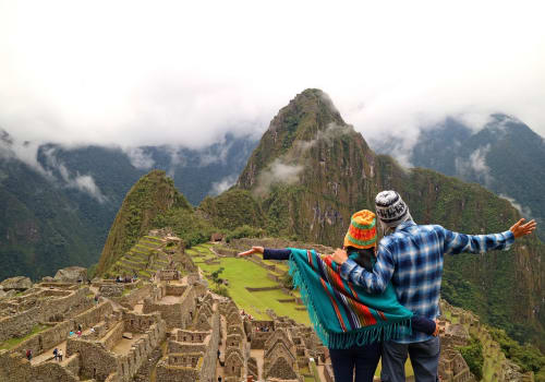
Rich in history, culture and ancient archaeology, Peru is brimming with more than its fair share of UNESCO World Heritage Sites. Perhaps none are more intriguing than the Nazca lines, one of the most awe-inspiring, remarkable, and yet puzzling archaeological areas in the world. But what are the Nazca lines, who made them and for what purpose? Let’s find out.
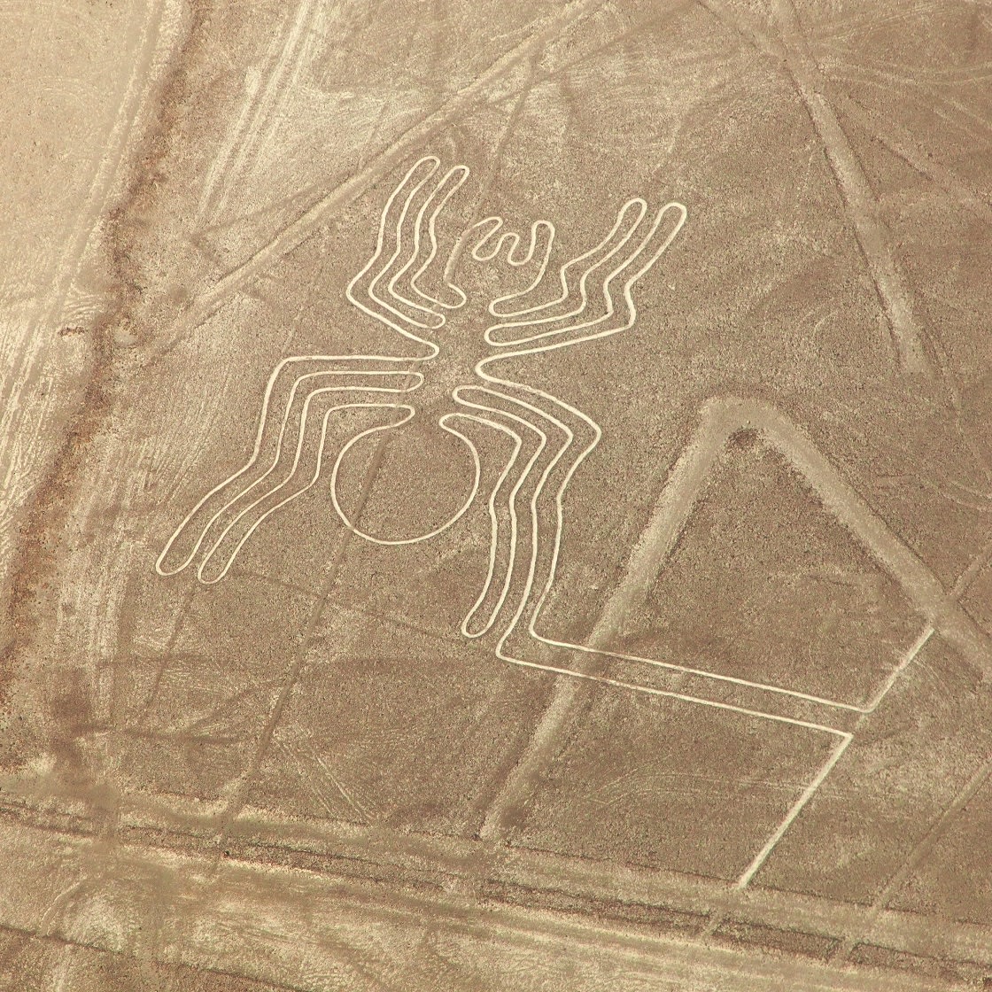
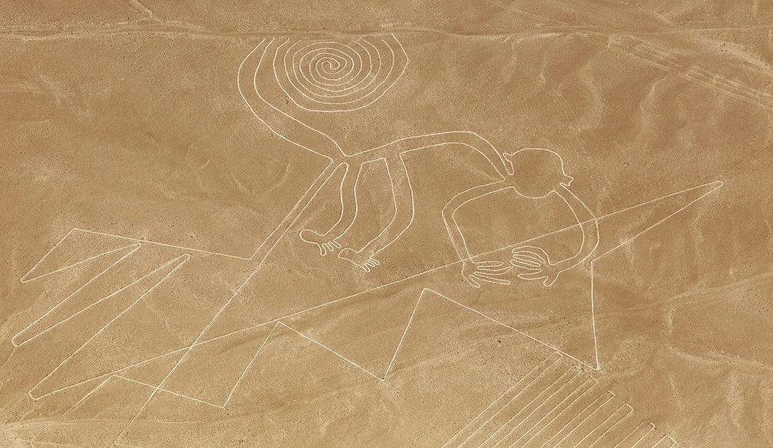
Aerial View Of The Spider Geoglyph, Nazca Mysterious Lines
They comprise a vast collection of over 300 geoglyphs and 70 plant and animal images (known as biomorphs) etched into the Peruvian desert floor. From the air they appear as supersized figures, including a whale, condor, snake, llama, spider, tree and flower, along with various geometric motifs such as spirals, wavy lines and triangles. The largest figure spans 1,200 feet, whilst some of the straight lines run up to 30 miles.

Nazca Lines In The Beautiful Nazca Desert
The Nazca lines are located on a plain between the Nazca and Inca valleys in southern Peru, and cover an estimated 170 square kilometres.
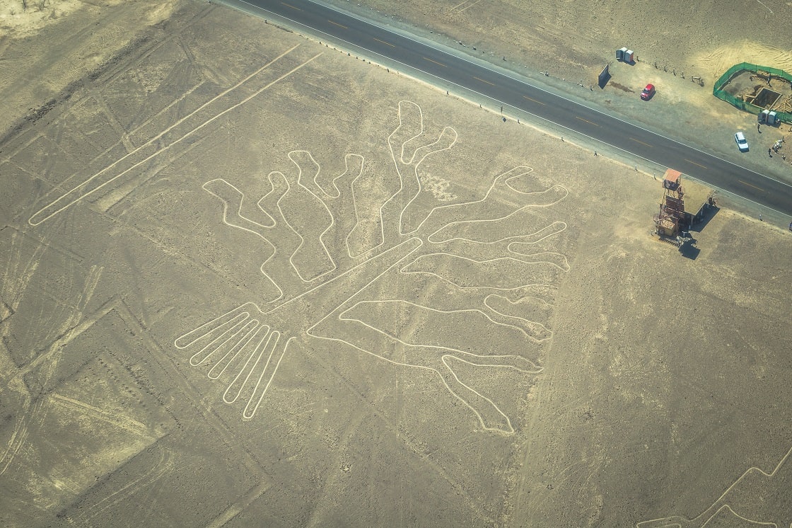
Tree Figure Of The Nazca Lines And The Observatory Tower To The Right
The lines are thought to be thousands of years old, created during the time of the Nazca Indians, an ancient prehistoric culture who flourished in the area between 200 BC and 600 AD. The designs were created through removing the dark red surface stones to expose a lighter-colored subsoil. The lines likely took a long time to create, perhaps taking several generations, so it’s clear that the people involved were heavily invested in the project.
The etchings were first discovered by Peruvian archaeologist Toribio Mejia Xesspe in 1927 when he was hiking through the area’s foothills. However, it wasn’t until the late 1930s that they were brought to the world’s attention. Researchers flying over the area surveying for water realized that the lines formed animal shapes, whilst an increase in commercial flights over in the area fueled further interest in the site.
Since their discovery, the Nazca lines have remained a source of great mystery to the world. Basic questions about precisely who made them, how and why, simply remain unsolved, largely because the ancient culture living in the area at the time didn’t keep written records. The particular question of how the artists were able to draw such precise figures on such a large scale without the benefit of a bird eye’s perspective is particularly curious, and has given rise to a few theories for their creation. The puzzle of how and why the Nazca lines were made have captured the imagination of numerous archaeologists, mathematicians, historians and anthropologists, who have proposed numerous theories in a an attempt to solve the enigma.
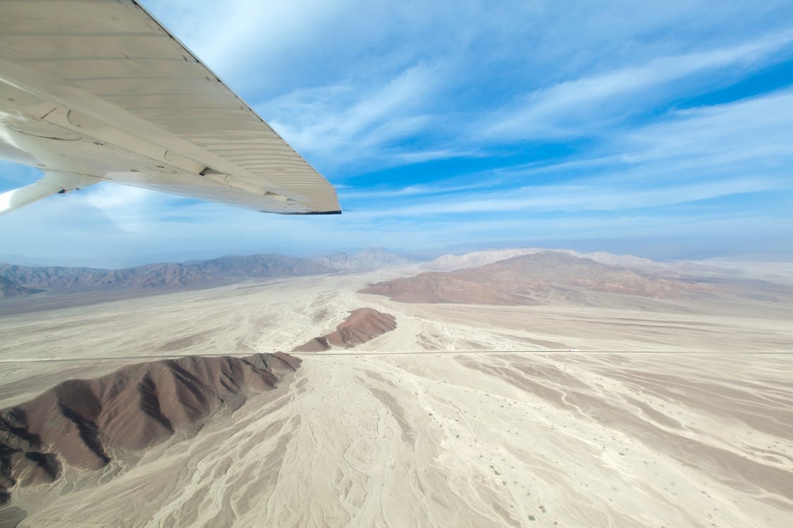
Overflight The Nazca Lines
You can check the lines out online using Google Earth, but that isn’t quite as exciting as seeing them in the flesh. No visit to Peru is complete without making the trip to witness this archaeological wonder for yourself. To appreciate the sight in all its glory, contact our destination specialists to arrange a Nazca Lines tour. The best views are had by taking to the sky via a small cessna plane from either the Maria Reiche Neuman Airport just outside Nazca, or from Pisco Airport.
Alternatively, there is also an observation tower along the Pan-American highway which offers fantastic views over three figures, but every single geoglyph can just about be spotted from somewhere on the ground, so taking to the foothills is another great way to experience the beauty and vast scale of the lines. You never know, maybe you will be the one to figure out what the Nazca Lines are?
While Rainforest Cruises aim to provide accurate and up-to-date information, we make no representations as to the accuracy or completeness of any information herein or found by following any link on this site. Rainforest Cruises cannot and will not accept responsibility for any omissions or inaccuracies, or for any consequences arising therefrom, including any losses, injuries, or damages resulting from the display or use of this information.